Catalog Archive
Auction 186, Lot 409

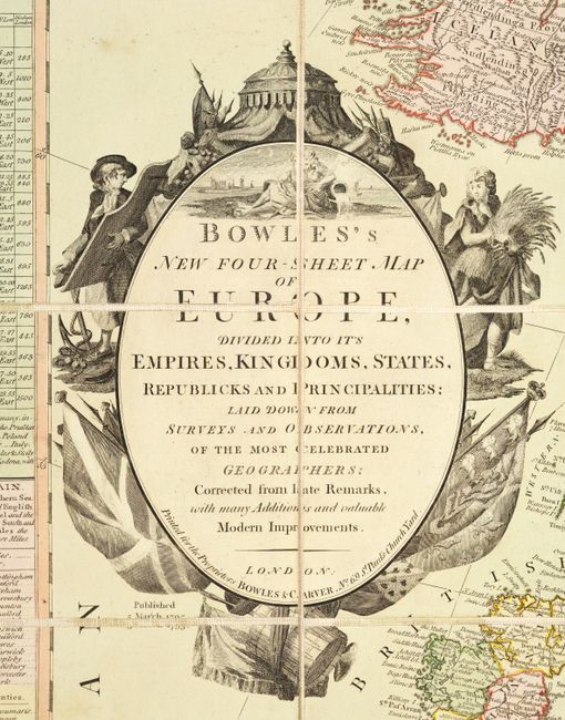
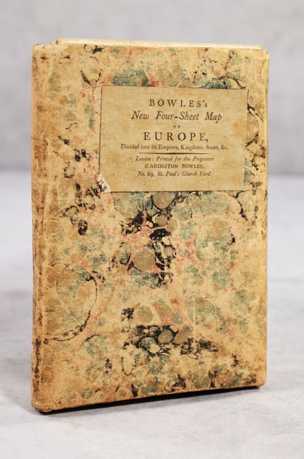
"Bowles's New Four-Sheet Map of Europe, Divided into Its Empires, Kingdoms, States, Republicks and Principalities...", Bowles & Carver
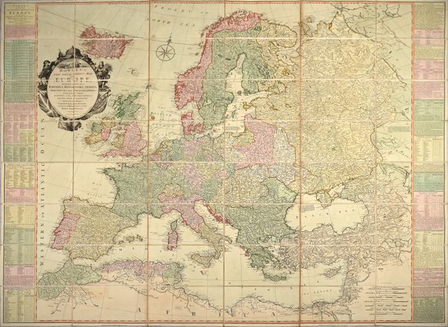
Subject: Europe

Period: 1795 (dated)

Publication:

Color: Hand Color

Size:
48.3 x 40.4 inches
122.7 x 102.6 cm
Download High Resolution Image
(or just click on image to launch the Zoom viewer)

This wall-sized map of Europe was printed on four sheets, dissected, mounted on linen, and folds into an attractive marbled slipcase. The map is densely engraved with cities, political boundaries, rivers and topography. Tables at the sides of the map provide a wealth of information on the major countries, divisions within each country, major cities and distances between cities. The lovely title cartouche features a river god, flags, and symbols of war and prosperity. The contemporary slipcase includes a printed title label and a list of other maps for purchase.

References:

Condition: B+

Full contemporary color with light soiling and a small stain in the North Sea. The slipcase is well worn with separations along the bottom edge, but is still intact.

Estimate: $550 - $700

Sold for: $650

Closed on 2/9/2022

Archived