Subject: Central South America, Paraguay
Period: 1638 (circa)
Publication: Theatre du Monde ou Nouvel Atlas
Color: Hand Color
Size:
18.9 x 14.8 inches
48 x 37.6 cm
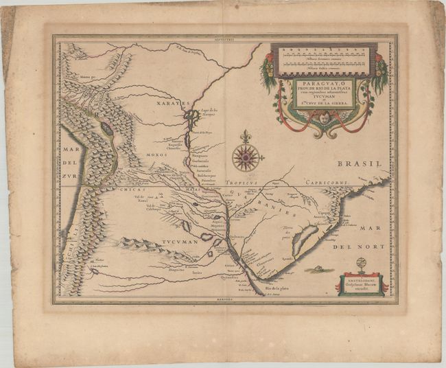
Superb map of the region including the Paraguay River basin and the Peru-Chilean coast with Lake Titicaca. The Rio de la Plata is boldly shown with many large islands in the broad river. The mythical Lago de los Xarayes is featured on the map, which was believed to connect the Rio de la Plata and Amazon River systems. Several towns are named including R. Ianeiro, S. Paulo, Buenos Ayres, Corduba, Medoca, Arica, Potosi and Cusco. A large decorative title cartouche incorporates the distance scales, while a smaller cartouche features an armillary sphere. A fine, large compass rose with fleur-de-lys also adorns the sheet. French text on verso, published between 1638-43. Two cracks in the plate are visible just to the left of the centerfold near the top of the map.
References: Van der Krogt (Vol. II) #9900:2A.2.
Condition: B+
A crisp impression with full contemporary color on a sheet with a "CV" watermark. There is light toning, a few spots of foxing in the image, and heavy soiling and foxing along the edges of the sheet, well away from the image.