Catalog Archive
Auction 186, Lot 352

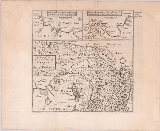
"A Map of the Isthmus of Darien, & Bay of Panama [on sheet with] The North Sea Coast of the Isthmus of America to the West of Portobel [and] The South Sea Coast of the Isthmus of America to the West of Panama", Dampier, William (Capt.)

Subject: Central America, Panama

Period: 1729 (circa)

Publication: A Collection of Voyages...

Color: Black & White

Size:
6.2 x 6.2 inches
15.7 x 15.7 cm
Download High Resolution Image
(or just click on image to launch the Zoom viewer)

This unusual sheet features three small maps illustrating William Dampier's travels around Central America during his first circumnavigation voyage in the 1680s. The largest of the maps depicts the Isthmus and Bay of Panama. Dampier participated in raids on Spanish ships in this region with Captain Bartholomew Sharp, an English buccaneer. The small map at top left depicts the stretch of coastline from Nicaragua to Portobelo. At top right, another small map depicts the southern coast of Panama from Quibo, or Quicaro, or Cobaya (Coiba Island) and nearby islands east to Panama City. Unmistakably engraved by Herman Moll in his charming and distinctive style.

References: Shirley (BL Atlases) G.DAM-2a #26.

Condition: B+

Issued folding with faint dampstains and light toning in the upper third of the sheet.

Estimate: $100 - $130

Sold for: $80

Closed on 2/9/2022

Archived