Subject: Central America
Period: 1850 (dated)
Publication: Ex. Doc. No. 75, 31st Congress, 1st Session
Color: Hand Color
Size:
31.9 x 23.3 inches
81 x 59.2 cm
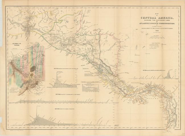
This handsome map of Central America illustrates the various proposed routes for a land route that would cut weeks off a journey from the Atlantic to the Pacific. The map shows four possible routes: "Across the Isthmus of Tehuantepec;" "From Port Sn. Juan del Norte to Port Realejo;" "From the Lake Nicaragua to Port San Juna del Sur;" and "Between Charges (Atlantic) and Vaca de Monte (Pacific)." A large and very colorful inset shows the geological formations on the Isthmus of Panama and the planned route in great detail. With the discovery of gold in California, this chart gained particular prominence and was copied in a U.S. government report. This example comes from that report, published in 1852.
References: Kapp (MCC-73) #114; Kapp (MCC-106) #191.
Condition: B+
Issued folding and now flattened and backed with tissue. There is light toning along the fold lines, faint offsetting, and a few creases adjacent to the left border.