Subject: Southwestern United States & Mexico, Texas
Period: 1845 (circa)
Publication: Morse's North American Atlas
Color: Printed Color
Size:
16.3 x 12 inches
41.4 x 30.5 cm
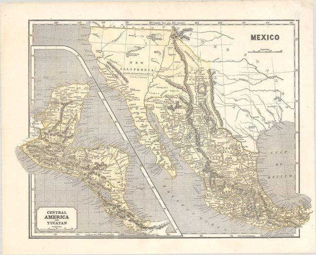
This early cerographic map was published in Morse'e North American Atlas. Wheat notes that this is the same map as published by the company in 1842. California and the western states are controlled by Mexico and shown as New California. Texas is Independent and the settlements of Austin, Nacogdoches, and S. Antonio de Bexar are located. This pre-Fremont map shows a large swamp in the area of today's Great Basin with rivers flowing across its expanse. The Great Salt Lake is here named L. Youia (salt) with the American Fur Depot on its eastern shore. With a large inset map "Central America and Yucatan."
References: Wheat (TMW) #469; Phillips (Atlases) #1228-35.
Condition: A
A dark impression on a clean sheet.