Subject: Texas, North America
Period: 1948 (dated)
Publication:
Color: Printed Color
Size:
22 x 16.9 inches
55.9 x 42.9 cm
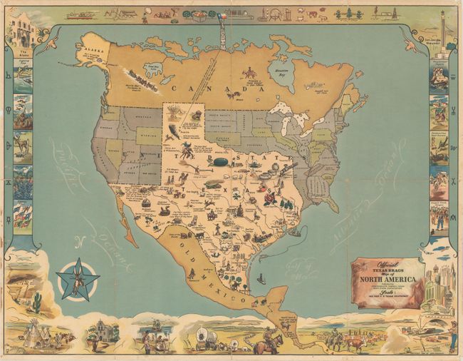
This humorous map of North America was drawn with a vastly oversized Texas occupying approximately half of the United States. The eastern part of the United States is playfully identified as "Unannexed Territory" and the western portion is "Ceded Territory." Texas is filled with illustrations and amusing text including "1 Texas inch Equals 2 Feet", "True location of North Pole - 36.04 mi due North of Amarillo", and "Beefiest Turkeys" to name a few. Surrounding the map image are a series of related vignettes including the Alamo, San Jacinto Monument, and "Rowdy Rodeos." Drawn and illustrated by Mark Storm and published by John Randolph.
References:
Condition: B+
Issued folding with light wear along the fold lines and pinholes in the margins. There are a few small edge tears and separations at top that have been closed on verso with archival tape, and some minor staining is confined to the left blank margin.