Subject: World
Period: 1838 (dated)
Publication:
Color: Hand Color
Size:
24.4 x 17.1 inches
62 x 43.4 cm
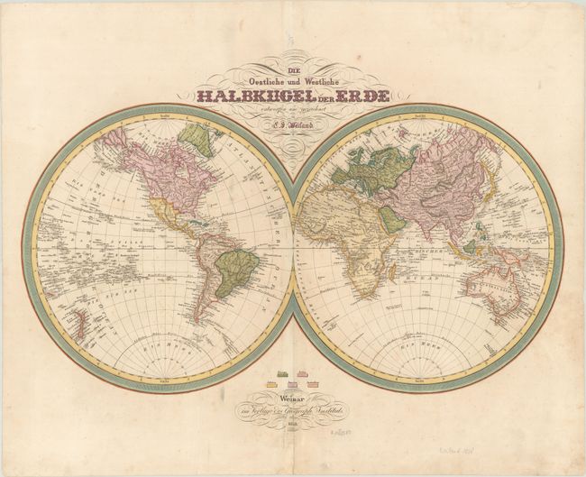
This German double-hemisphere world map features nice detail of the continents throughout. In North America, Texas is named but is still a part of Mexico along with the rest of the present-day America Southwest. A conjectural river connects the mythical Timpanagos S. to San Francisco Bay. The Great Salt Lake is identified. There appears to be a remnant of the Sea of the West in the Pacific Northwest - an extremely late appearance of the myth - but it is unclear whether or not it is just the work of a rogue colorist. A couple fragments of coastline near the South Pole hint at Antarctica. The Great Wall of China is depicted.
References:
Condition: B+
There is light scattered foxing and soiling and a tiny hole in Scandinavia only visible when held to light. There is a centerfold separation and a few associated tears in the publisher's imprint at bottom, all of which have been archivally repaired.