Subject: Pennsylvania
Period: 1835 (dated)
Publication:
Color: Hand Color
Size:
15 x 12.5 inches
38.1 x 31.8 cm
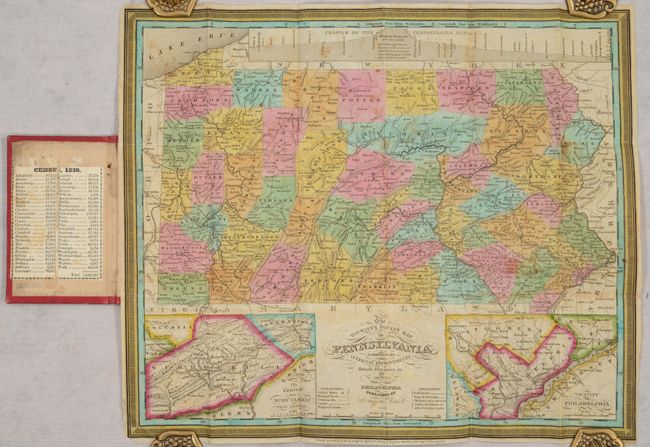
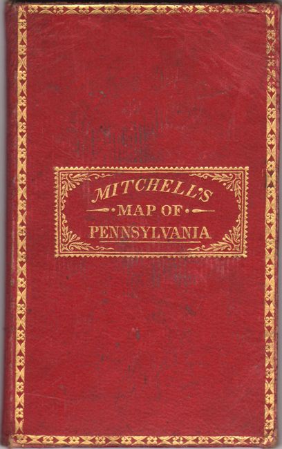
This attractive example features insets of the Lehigh and Schuylkill Coal Regions and the Vicinity of Philadelphia, with a large profile of the Pennsylvania Canal across the top. The map is finely engraved with detail throughout locating many roads, towns, and railroads (both proposed and developed) with good topographical information. Juniata County now appears on the map (1831), making the county configuration up to date as of the publication date. This plate originally was used by Finley, but Mitchell purchased his plates in 1831 and issued them under his own name. Engraved by D. Haines. Printed on fine banknote paper and folds into original, gilt-stamped red leather covers measuring 3" x 5". Original paper label inside the front cover gives population by county from the 1830 census.
References:
Condition: B+
Issued folding on banknote-style paper with light scattered foxing and two short splits at the fold junctions. Covers are lightly worn.