First Official Statehood Map of New Mexico
"State of New Mexico Compiled from the Official Records of the General Land Office and Other Sources...", General Land Office
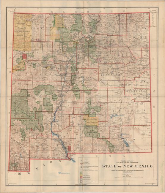
Subject: New Mexico
Period: 1912 (dated)
Publication:
Color: Printed Color
Size:
31.5 x 36.8 inches
80 x 93.5 cm
This large-format map was the first official state map of New Mexico, compiled by I.P. Berthrong and issued under the direction of the GLO Commissioner Fred Dennett. It is filled with colorful details including Forest Reserves, Indian Reservations, Military Reserves, Private Grants, reclamation projects, and more. The map further locates watersheds, mountains, railroads, a few areas of unsurveyed townships, and more. Backed on linen.
This historically significant map was featured during the state's centennial exhibition as the first official statehood map. Click here for details.
References:
Condition: A
Issued folding and backed on linen with minor soiling confined to the blank margins.