Subject: Nebraska
Period: 1858 (dated)
Publication: Wagon Roads... A Report Upon the Several Roads Constructed...
Color: Black & White
Size:
24 x 26.5 inches
61 x 67.3 cm
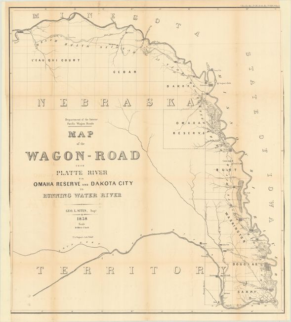
This detailed map following the course of the Missouri River from Omaha to Niobrara was issued in Albert Campbell's 125-page "Report Upon the Several Wagon Roads Constructed Under the Direction of the Interior Department." Towns located include Omaha, De Soto, Decatur, Omadi, St. Johns, Ponca and Concord plus many smaller settlements and Indian Villages. Surveyed by George L. Sites, Superintendent.
In 1857 Congress approved funding for the construction of two Pacific Wagon Roads (a southern and central route), though the Civil War impacted its construction. Carl Wheat devotes a chapter to the wagon road project, concluding "The Department of the Interior was caught up in the currents that surrounded the oncoming Civil War, and little came of the imposing wagon road program that it had set in motion. [However] its efforts were of great effect on all parts of the West."
References: Howes #C-86; Wagner-Camp #321,
Condition: B
Issued folding and now flattened and backed with tissue to extend the side margins, which were trimmed to just inside the neatline by the binder at bottom left and top right. There is light toning along the fold lines and a few small fold separations that have been archivally repaired on verso.