Subject: Maine
Period: 1963 (dated)
Publication:
Color: Printed Color
Size:
17.4 x 22.9 inches
44.2 x 58.2 cm
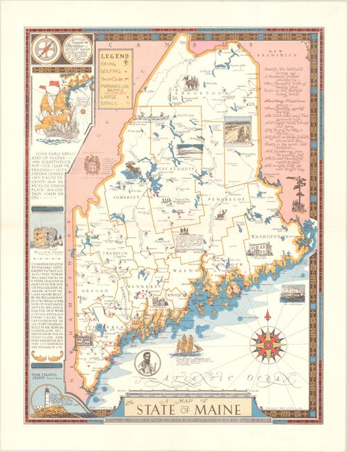
This beautifully designed pictorial map of Maine was originally published by Luther S. Phillips in 1946; this example is a revised edition by Augustus D. Phillips, published in 1963. Small illustrations peppered throughout the landscape depict the state's culture, wildlife (including a bear and a moose), and historical houses. A legend at top left identifies the state's recreational attractions, showing skiing, golfing, yacht clubs, and marinas. Penobscot County is noted as "the leading lumber port of the world in the 'pine period.'" Decorations along the left side of the map show the astrolabe of Samuel de Champlain; a reproduction of part of de Laet's map of the region with a galleon; Fort William Henry; and Star Island Light. An excerpt from Quaker poet John Greenlead Whitier's "Mogg Megone" appears in New Brunswick. In the Atlantic, there is an ornate compass rose. The map is surrounded by a lovely border.
References:
Condition: A
Clean and bright. Folded by a previous owner, with a tiny separation at the fold intersection.