Subject: Florida
Period: 1845 (dated)
Publication:
Color: Black & White
Size:
25.4 x 22.5 inches
64.5 x 57.2 cm
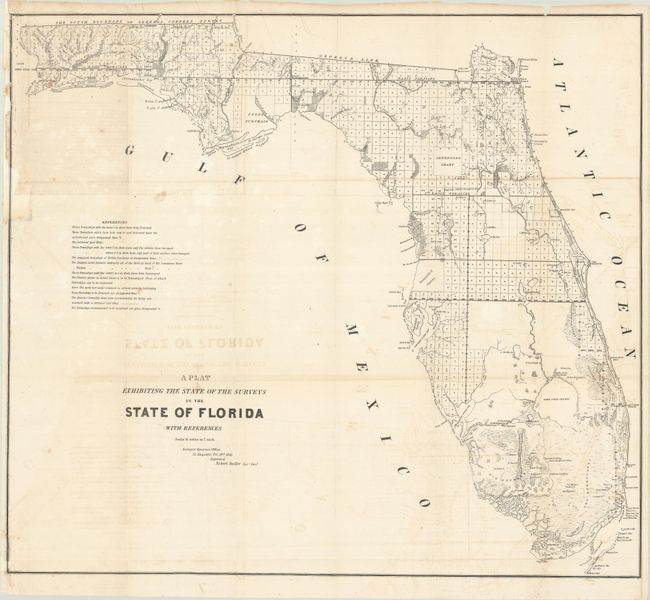
An interesting and detailed early lithographed map representing the progress of surveying in the state. The Everglades, Big Cypress, Arredondo Grant, Forbes Purchase and numerous forts are clearly shown. It extends to show Key Largo, here named as Cayo Largo. The map is filled with detailed notes related to surveys and townships. This map was produced in a period of relative peace between the U.S. and Seminole Nation. The third and final Seminole War waged between 1855 and 1858. Issued from St. Augustine by Robert Butler, Surveyor General, dated October 20, 1845.
References:
Condition: B
Issued folding and now flattened and backed with tissue. There is light offsetting, minor foxing, and portions of the left border have been replaced in facsimile.