Catalog Archive
Auction 186, Lot 26

"Planiglobium Terrestre ou Mappe-Monde", Holtrop, W.
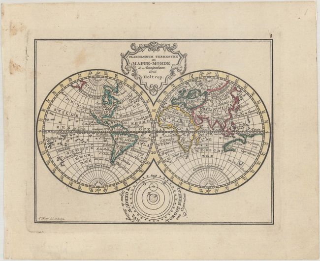
Subject: World

Period: 1790 (circa)

Publication: Zak-Atlas

Color: Hand Color

Size:
4.8 x 3.8 inches
12.2 x 9.7 cm
Download High Resolution Image
(or just click on image to launch the Zoom viewer)

This charming and uncommon miniature map of the world focuses on important rivers and includes place names of countries and a few regions. The northwest coast of North America is blank, and a partially delineated Australia is nearly attached to New Guinea (although the hand coloring makes it appear attached). Below the hemispheres is a small diagram of the solar system based on the Copernican theory. Engraved by C. Sepp.

References: Shirley (BL Atlases) T.HOLT-1a #1.

Condition: B+

Contemporary outline color on a bright sheet with light soiling and small remnants of hinge tape on verso.

Estimate: $275 - $350

Sold for: $200

Closed on 2/9/2022

Archived