Subject: Los Angeles, California
Period: 1921 (dated)
Publication:
Color: Printed Color
Size:
15.5 x 24 inches
39.4 x 61 cm
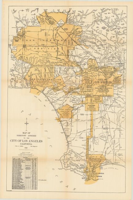
An uncommon map of the Los Angeles region that depicts the then-present boundaries of the city. It delineates the original square boundary of the city as of 1850 with the numerous additions/consolidations radiating both south and west. A table at bottom left shows the annexation history. Compiled by John A. Griffin, City Engineer. No past sales record located for this 1921 edition and no institutional listings found on OCLC.
References:
Condition: B+
Issued folding with some light color offsetting at lower left and a couple of short splits at the fold junctions. There is a manuscript ink notation on verso along the top left sheet edge.