Subject: San Francisco Bay Area, California
Period: 1915 (published)
Publication:
Color: Black & White
Size:
18.9 x 15.9 inches
48 x 40.4 cm
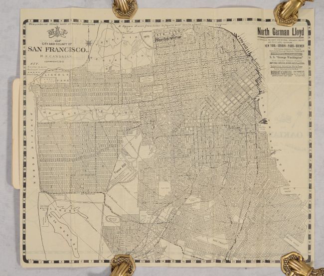
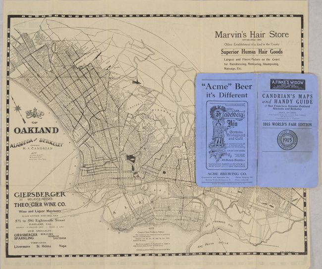
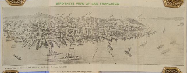
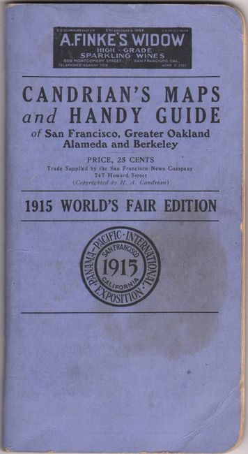
This 96-page guidebook by H.A. Candrian was produced for the Panama-Pacific Exposition (1915 World's Fair). While the fair's name gave recognition to the recently completed Panama Canal, it also gave the city of San Francisco an opportunity to showcase itself following the 1906 earthquake. The guidebook features a two-sided folding map showing the cities of San Francisco and Oakland & Vicinity. The San Francisco map locates the Presidio, Golden Gate Park, and Lincoln Park with a key further identifying railroads and street car lines. Pasted to the front wrapper is a small bird's-eye view of San Francisco (13.2 x 4.4"). Text includes a street index, list of important buildings, and several local advertisements. Blue printed wrappers (3.8 x 7.1"). We found no past sales records for this 1915 edition or institutional examples on OCLC.
References:
Condition: B+
Folding map is clean and bright with a few minor abrasions on the verso map at right where it was glued to the rear wrapper. Wrappers have light wear with a stain on the front wrapper.