Subject: Marin County, California
Period: 1863 (dated)
Publication:
Color: Hand Color
Size:
24.1 x 15.3 inches
61.2 x 38.9 cm
The Office of Coast Survey is the oldest U.S. scientific organization, dating from 1807 when Congress directed that a "survey of the coast" be carried out. By 1836, it was called the U.S. Coast Survey and in 1878, the name was changed to the U.S. Coast and Geodetic Survey. Today the Office of Coast Survey is a division of the National Oceanic and Atmospheric Administration NOAA.
The survey teams, composed of civilians as well as Army and Naval officers, charted the nation's waterways and produced a wide array of reports, survey charts, hydrographic studies of tides and currents, astronomical studies and observations, and coastal pilots. These charts are an important record of the changing nature of the nation's coastlines. In additional to coastal charts, the U.S. Coast and Geodetic Survey produced land sketches, Civil War battle maps, and the early aeronautical charts.
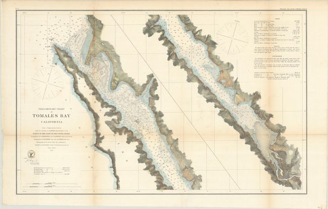
This detailed chart depicts the narrow 15-mile Tomales Bay which separates present-day Point Reyes National Seashore from mainland Marin County. The bay is presented in two strip sections with numerous soundings and bottom types in the waters. A table at top right provides additional details on tides, soundings, and more.
References:
Condition: B+
Issued folding and now flattened and backed with tissue. There is light toning along the fold lines.