Subject: World
Period: 1760 (circa)
Publication:
Color: Hand Color
Size:
25.9 x 17.1 inches
65.8 x 43.4 cm
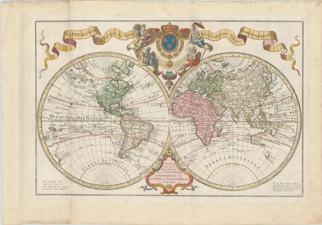
Covens and Mortier issued this impressive double-hemisphere map, based upon the work of both Delisle and Buache. The routes of numerous explorers are depicted, including Magellan (1520), Mendanna (1595), Quiras (1605), Le Maire (1615), Tasman (1642), St. Louis (1708), and Antoine (1710). The colonies are confined to the eastern seaboard in North America, with Louisiane encompassing the interior. The western portion of North America is still largely blank with the exception of a large Mer de l'Ouest. The northwestern coastline is broken with some conjectural stretches and several notes of explorers' discoveries, culminating in an extended and unusually-shaped peninsula where Alaska should be. In the eastern hemisphere, the islands of Terre de Etats and Terre de la Compagnie are located east of Jedso (Hokkaido), based on the reports of Maarten Gerritsz de Vries in 1643. Australia and New Zealand are only partially mapped, and it is left ambiguous as to whether Australia and New Guinea are connected. Above the map is a decorative cartouche featuring the French coat of arms surrounded by allegorical figures representing the four continents. This is State 2a as identified by McGuirk, with both the Sea of the West and the odd proto-Alaska. Engraved by J. Condet. Printed on two joined sheets, as issued.
References: McGuirk #82.
Condition: A
Contemporary color on watermarked paper with minor soiling, most of it confined to the blank margins, and a few marginal edge tears that have been archivally repaired on verso.