Catalog Archive
Auction 186, Lot 22

"Mappe Monde ou Description Generale du Globe Terrestre Suivant les Observations de Messieurs de Lacademie Royale des Sciences", Anon.
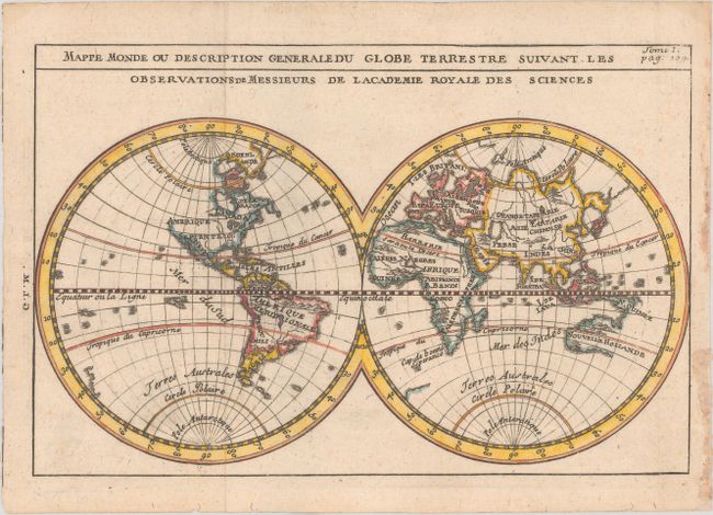
Subject: World

Period: 1750 (circa)

Publication:

Color: Hand Color

Size:
8.2 x 5.4 inches
20.8 x 13.7 cm
Download High Resolution Image
(or just click on image to launch the Zoom viewer)

This charming little double-hemisphere map depicts an early 18th century view of the world based on the cartography of Delisle. Although California is depicted in a peninsular formation, the northwestern coast of North America is left entirely blank. Only the western half of Australia's (Nouvelle Hollande) coastline is delineated, and it is shown attached to New Guinea. New Zealand is partly illustrated but is not named. In the north Pacific, Japan is attached to a large Yedo, with the hint of another landmass just to the east.

References:

Condition: A

A crisp impression, issued folding on paper with a bunch of grapes watermark, tiny worm tracks in the bottom blank margin, and some bits of paper glued to the recto in the right blank margin.

Estimate: $160 - $190

Sold for: $130

Closed on 2/9/2022

Archived