Subject: South Central United States
Period: 1866 (dated)
Publication:
Color: Hand Color
Size:
38.3 x 25.1 inches
97.3 x 63.8 cm
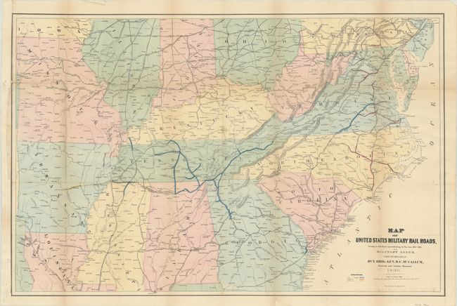
This Interesting map was produced in the year following the close of the Civil War, and shows military railroads under the command of Union General McCallum. It provides a clear picture of the railroads involved in the theater of operations during the Civil War. The legend uses color to delineate the various rail gauges throughout the map including 5 ft., 4 ft. 8 1/2 in., and 5 ft. 6 in. gauges. The map is centered on Tennessee and extends northward to show much of Pennsylvania, Ohio, Indiana, and Illinois. To the west is Missouri, with parts of Arkansas and Louisiana, but not to the Gulf Coast. It is filled with place names including some errors like Marks Corner for Moncks Corner, South Carolina. There is good detail along the Atlantic coast, and the scale is large enough to easily track military operations and troop movements.
References:
Condition: B+
Issued folding and now flattened and backed with tissue to reinforce and repair a 3" binding tear at left and several small fold separations. There is some light toning along the fold lines and a binding trim at left has been replaced with old paper.