Catalog Archive
Auction 186, Lot 193

Very Early Mitchell Pocket Map

"Map of Massachusetts Connecticut and Rhode Island Constructed from the Latest Authorities", Mitchell, Samuel Augustus

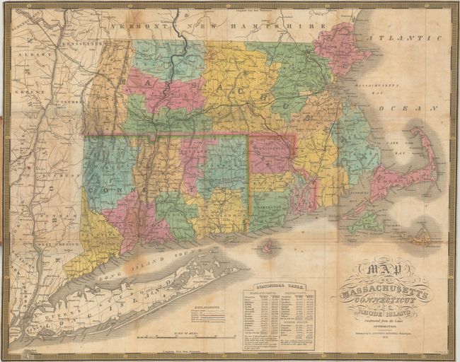
Subject: New England United States

Period: 1831 (dated)

Publication:

Color: Hand Color

Size:
21.4 x 16.9 inches
54.4 x 42.9 cm
Download High Resolution Image
(or just click on image to launch the Zoom viewer)

This very early pocket map by Mitchell utilized the plates from Finley's 1826 atlas with an updated publisher's imprint. It depicts counties, roads, proposed and existing canals & railroads, and locates scores of towns and villages. At bottom is a "Statistical Table" giving populations by county for 1810 and 1820. Surrounded by a keyboard-style border. Engraved by J.H. Young. Folds into brown leather boards (3.5 x 6.0") with gilt title on the front cover.

References:

Condition: B

Issued folding with light staining and offsetting, minor foxing, and several small fold separations. Trimmed to the border on all sides as issued. Covers are very good with minor soiling and a bit of sunning along the spine.

Estimate: $275 - $350

Sold for: $200

Closed on 2/9/2022

Archived