Subject: Eastern United States
Period: 1836 (dated)
Publication:
Color: Hand Color
Size:
23.3 x 18.9 inches
59.2 x 48 cm
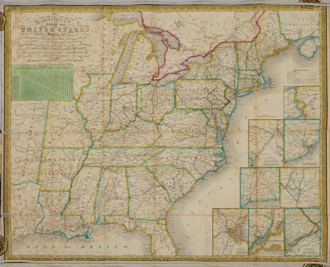
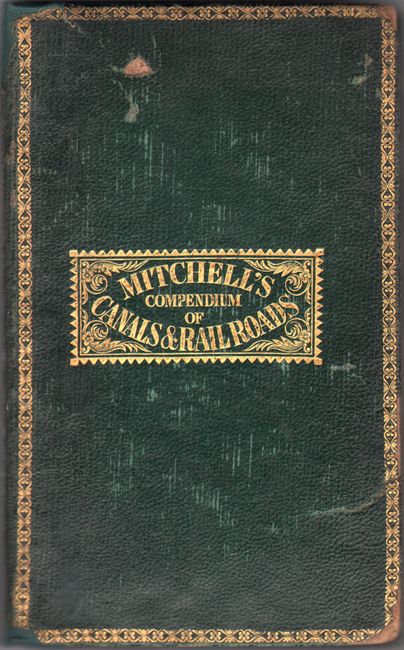
This uncommon pocket map shows the United States west to the Mississippi River and a little beyond to include parts of Texas and Missouri Territory. It is very detailed and features eight insets: the environs of Philadelphia, Baltimore and Washington, Charleston, Boston, New York, Albany, Hartford and New Haven, and Niagara Falls. The labyrinth of canals and early railroads is clearly delineated. As a traveler's map, it features a detailed table which lists the distance between twenty-five cities. Mitchell's early series of maps, first published in 1832, was designed for the market represented by the burgeoning number of travelers and new immigrants. The maps were printed on thin bank note paper and folded so they could be carried easily for quick reference while traveling. Embellished with keyboard-style border and fancy titling. The map is accompanied by the 84-page Compendium of the Internal Improvements and 3 pages of advertisements. Rebacked in green cloth over original green leather boards with gilt title on the front cover.
References: Phillips (Maps) p. 889.
Condition: C+
Issued folding with heavy foxing and numerous fold separations that have been archivally repaired on verso. Two small separations along the left sheet edge have been repaired on recto with tissue. Accompanying text has scattered foxing. Rebacked with light wear and a few small gouges to the boards.