Subject: North America
Period: 1803 (dated)
Publication:
Color: Black & White
Size:
16.9 x 13.4 inches
42.9 x 34 cm
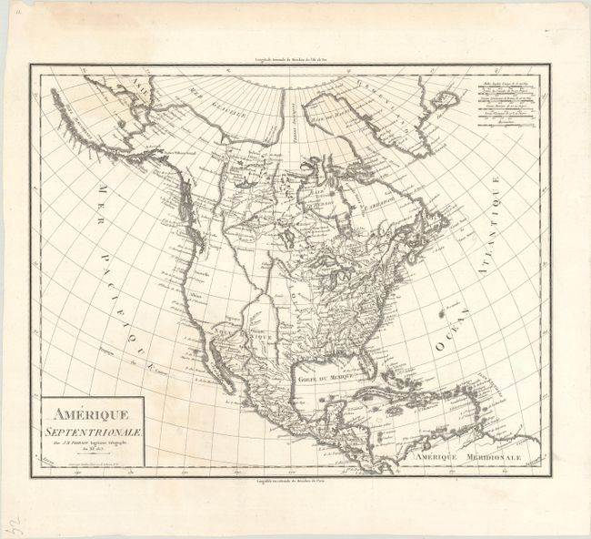
This attractive map shows the newly acquired Louisiane as a United States possession. The territory was acquired shortly before the publication of this map, which is also dated 1803. The western third of the continent is under Spanish control with almost no inland detail and only a few place names along the coast including New Albion and New Georgia. The supposed course of the Columbia River is shown flowing into British Columbia. A possible Northwest Passage is shown via the Mer Selon Arrowsmith. The map extends to include the Caribbean islands and northern South America. Decorated by a simple block-style title cartouche and six distance scales.
References:
Condition: B+
A nice impression on a bright sheet with a sun-shaped medallion, several faint dampstains, and a professionally repaired hole to the right of the title cartouche.