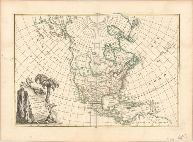
Subject: North America
Period: 1782 (dated)
Publication:
Color: Hand Color
Size:
17.9 x 12.3 inches
45.5 x 31.2 cm
This is one of the more interesting transitional states of this great 18th century map. The map was first issued in 1762 with an extensive network of rivers and lakes in present-day Canada that hinted at the possibility of a Northwest Passage. This edition, dated 1782, has been significantly re-engraved. The potential passage has been erased and a confused group of islands and notations about the Russian discoveries are now depicted in the region of Alaska. The salient feature is still the gigantic, and entirely mythical Sea of the West near modern-day Seattle, connected to the Pacific by the straits of Juan de Fuca and Martin d' Aguilar. New Albion is on the southwest shore of this great inland sea, which inundates virtually all of present-day British Columbia and Alberta. The new United States is formed east of the Mississippi, and French Louisiana stretches to the Pacific Northwest. Florida, Cuba and Nouveau Mexique are controlled by Spain. The large, decorative title cartouche incorporates a palm tree and grape vines.
References: McGuirk #109; cf. Sellers & Van Ee #93.
Condition: B+
A nice impression on a watermarked sheet with a couple of stains along the lower centerfold.