Subject: Colonial North America
Period: 1740 (circa)
Publication:
Color: Hand Color
Size:
10.1 x 7.8 inches
25.7 x 19.8 cm
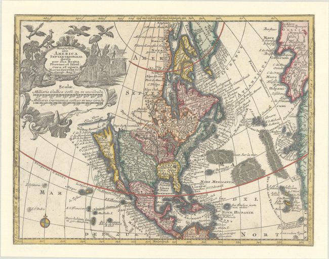
A superb small map with California as an island on the second Sanson model, showing two bays on the north end of the island. The island is also very narrow in the center, almost becoming two islands, a theory proposed by Father Luis Velarde. The map is densely covered with place names, and the northern extremes are strangely elongated. The large title cartouche, surrounded by Native Americans and birds conveniently obscures the northwest coast with the exception of a portion of the Terra Esonis incogn. Tobias Conrad Lotter's strong engraving style is evident. This is the second state per McLaughlin, however the engraver and publisher's imprints at bottom have been trimmed away.
References: McLaughlin #221; Tooley (America) #95.
Condition: B+
Clean and bright, trimmed to the neatlines with loss of the engraver and publisher's imprints, and pasted onto a sheet to create margins.