Catalog Archive
Auction 185, Lot 90

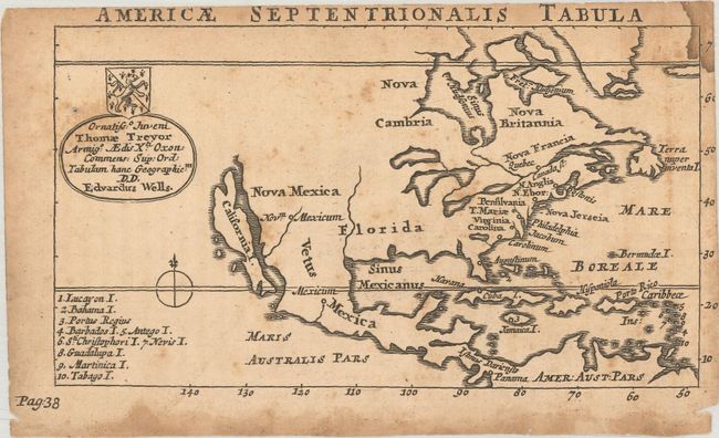
"Americae Septentrionalis Tabula", Wells, Edward

Subject: Colonial North America

Period: 1726 (circa)

Publication: Geographia Emendata & Locupletata

Color: Black & White

Size:
6.2 x 3.4 inches
15.7 x 8.6 cm
Download High Resolution Image
(or just click on image to launch the Zoom viewer)

This interesting and uncommon little map is from a children's geography. It is a reduced version of Wells' large map of North America with less detail. It features the island of California and enlarged Great Lakes. The Mississippi River empties in the Gulf of Mexico too far to the west, and the Rio Grande empties incorrectly into the Gulf of California. The map is dedicated to Thomas Treyor with his coat of arms.

References: McLaughlin #205.

Condition: B

There is light toning, scattered foxing, and dampstains in the top right corner and bottom blank margin.

Estimate: $180 - $220

Sold for: $130

Closed on 11/17/2021

Archived