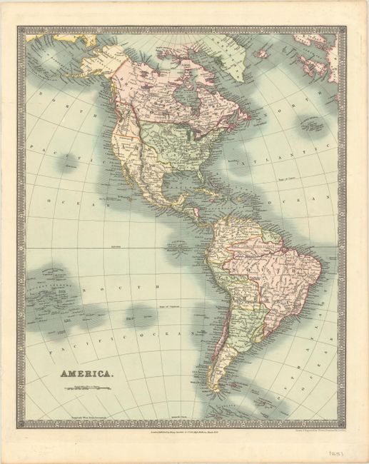
Subject: Western Hemisphere - America
Period: 1831 (dated)
Publication: A New General Atlas of the World
Color: Hand Color
Size:
13.2 x 16.1 inches
33.5 x 40.9 cm
The United States and Great Britain established in 1818 joint claim over the Oregon Territory - the region north of Spanish controlled Upper California up to the southern boundary of Russia's Alaska Territory at North latitude 54°40'. By the late 1830's this arrangement was beginning to fall apart.
In the 1840's the expansionist Democrats, including their 1844 presidential candidate, James Polk, claimed the entire region for the United States. Their expansionist desires were expressed by Polk's famous campaign slogan, "Fifty-four Forty or Fight!" The slogan also became a rally cry for Americans desiring to settle the territory. Following Polk's election, the dispute was resolved by the 1846 Treaty of Oregon, which struck a compromise that fixed the U.S./Canadian boundary at 49º North.
Well engraved map that features the Western Territory of the United States extending well into present-day Canada, reflecting US claims in the region. Mexico is in control of Texas and the Southwest. Alaska is Russian Territory, and Canada in its entirety is labeled British Territory. Published by Henry Teesdale & Co. in London.
References:
Condition: A
Bright, contemporary color on paper watermarked "J. Whatman 1831" with a tiny tear in the left blank margin that has been archivally repaired.