Subject: References
Period: 1969-2006 (published)
Publication:
Color: Printed Color
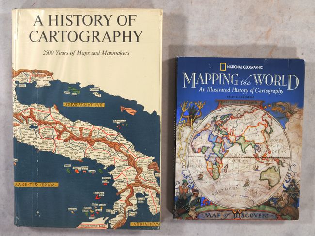
A. A History of Cartography - 2500 Years of Maps and Mapmakers, by R.V. Tooley & Charles Bricker, published 1969 (11.0 x 16.3"). This is Tooley and Bricker's Landmarks of Mapmaking under an alternate title, published by Thames and Hudson Ltd., London. Charles Bicker wrote this beautifully produced and well-illustrated cartographic reference. It covers the exploration and mapping of Europe, Asia, Africa, the Americas, and Australia. The preface is by Gerald Roe Crone, and the maps were chosen by R. V. Tooley. Comprised of 276 pages, over 350 illustrations, including maps, portraits, title pages, and reproductions from early sources, 14 color folding maps, other color illustrations, bibliography, and index. Folio, hardbound in blue cloth, gilt lettering on spine, gilt publisher's insignia on front cover, pictorial end-papers, and dust jacket. Condition: Contents are near fine with a touch of toning along some of the pages. Dust jacket has minor wear.
B. Mapping the World - An Illustrated History of Cartography, by National Geographic Society, published 2006 (9.5 x 12.3"). This elegantly designed and thoughtfully compiled reference traces the history of mapping from the earliest known world map to modern virtual mapping. It includes over 100 maps and other illustrations, all in color. Edited by Ralph E. Ehrenberg. 256 pages. Hardbound in black faux-leather with silver titles on front cover and spine. All edges silver. Condition: Contents and covers like new, with minor wear to the dust jacket.
References:
Condition: A
See description above.