Subject: Pacific Islands
Period: 1777-95 (circa)
Publication:
Color: Hand Color
Captain James Cook (1728-1779) is best known for his three voyages to the Pacific (1768-71; 1772-75; and 1776-79). His discoveries radically changed the western understanding of the world in the late 18th century. He was the first to circumnavigate and chart New Zealand and provided the earliest European accounts of exploration along the eastern coast of Australia and the Hawaiian Islands. On February 14th, 1779, he was killed on Hawaii after attempting to kidnap the chief of the island.
Many contemporary accounts of Cook’s voyages, including charts and engravings, appeared in the late 18th century. The first official account of Cook’s first voyage was published in 1773 by John Hawkesworth in Volumes II and III of An Account of the Voyages Undertaken by the Order of His Present Majesty for Making Discoveries in the Southern Hemisphere... William Strahan and Thomas Cadell published the first official accounts of the second and third voyages in 1777 and 1784. Accounts of his exploration were subsequently translated into French, German, and Dutch.
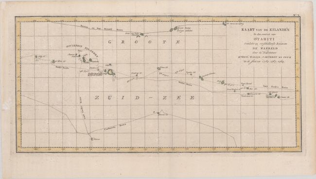
A. Kaart van de Eilanden in den Omtrek van Otahiti Ontdekt op Verschillende Reizen om de Waereld door de Kapiteinen Byron, Wallis, Carteret en Cook in de Jaaren 1765, 1767, 1769, from Reizen Rondom de Waereld door James Cook..., by (Capt.) James Cook, circa 1795 (19.5 x 9.4"). This is a Dutch edition of Cook's chart depicting the Society Islands, including Tahiti, and the tracks of Commodore Byron, Capt. Cook, Capt. Carteret, and Capt. Wallis. It was drawn on a Mercator projection. Condition: Issued folding with the watermarks of "C. & I. Honig" and a Strasburg bend and lily. There are a few tiny worm holes in the map image and a binding trim in the left blank margin that has been replaced with old paper.
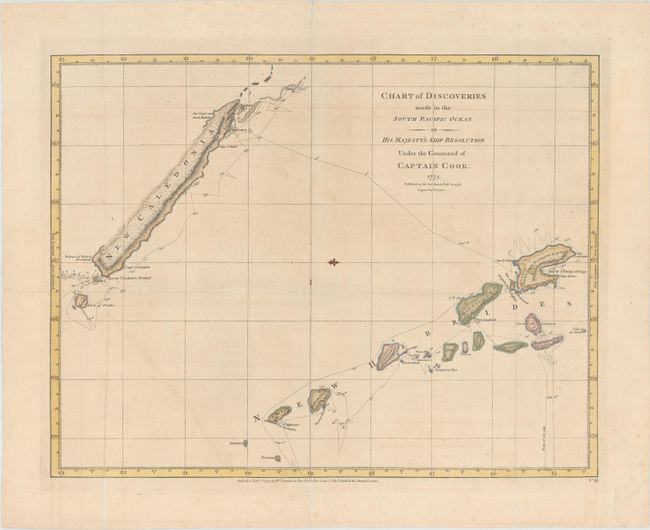
B. Chart of Discoveries Made in the South Pacific Ocean in His Majesty's Ship Resolution Under the Command of Captain Cook, from A Voyage Towards the South Pole, dated 1777 (18.5 x 14.3"). This chart shows the track of Cook's ship Resolution during his second voyage from July 16 to September 28th, 1774, sailing around the islands of New Hebrides and New Caledonia. A fleur-de-lis orients north to the right of the map. Engraved by W. Palmer and published by William Strahan and Thomas Cadell. References: Shirley (BL Atlases) G.COOK-1a #9. Condition: Issued folding, now flattened, with light soiling and archival repairs to several short fold separations.
References:
Condition: B+
See description above.