Subject: North Pacific Ocean
Period: 1784-1800 (circa)
Publication:
Color:
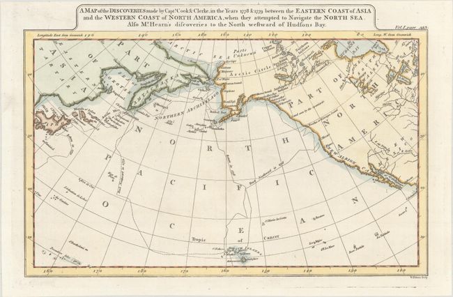
A. A Map of the Discoveries Made by Capts. Cook & Clerke, in the Years 1778 & 1779 Between the Eastern Coast of Asia and the Western Coast of North America, When They Attempted to Navigate the North Sea..., by John Payne, from Universal Geography..., circa 1800, hand color (11.3 x 7.6"). This chart details the track of the explorations of Captain Cook in 1778 & 1779 including the ill fated stop in Hawaii, here called the Sandwich Islands. It covers the area from eastern Asia and Japan to California. The Aleutian chain is labeled the Northern Archipelago. Dotted lines show the routes traveled by the explorers. Engraved by William Palmer. References: McCorkle (18th C. Geography Books) #325-12; cf. Wheat & Brun #24. Condition: A crisp impression on paper with a small crown watermark.
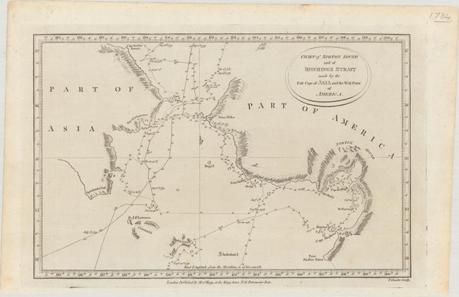
B. Chart of Norton Sound and of Bherings Strait Made by the East Cape of Asia and the West Point of America, by Alexander Hogg, circa 1784, black & white (12.8 x 8.3"). This chart covers the area on either side of the Bering Strait including Norton Sound with the Resolution's route detailed with day-to-day notations during Cook's voyage in 1779. Details include sections of the coastline and islands with many place names, soundings and anchorages. Engraved by Thomas Conder. Condition: There are a couple faint spots.
References:
Condition: A
See description above.