Subject: North Pacific Ocean, Alaska
Period: 1775-95 (circa)
Publication:
Color: Hand Color
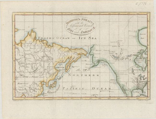
A. Bhering's Straits with the Adjacent Coasts of Asia and America, by Alexander Kinkaid, from A New Geographical, Commercial, and Historical Grammar..., circa 1790 (9.7 x 6.2"). This small map extends from the Tropic of Cancer through the Bering Strait to the Frozen Ocean or Icy Sea. It shows a rudimentary depiction of Alaska with underdeveloped Aleutian Islands and a speculative northern coastline. Place names along the Alaskan coast include Cape Newenham, Cape Stephens, Norton Sound, Cape Prince of Wales, Cape Mulgrave, Cape Lisburn, and the Icy Cape. Includes good detail of the interior river systems in both Asia and North America. Engraved by J. Fraser. Reference: McCorkle (18th C. Geography Books) #208-21 (Vol II).
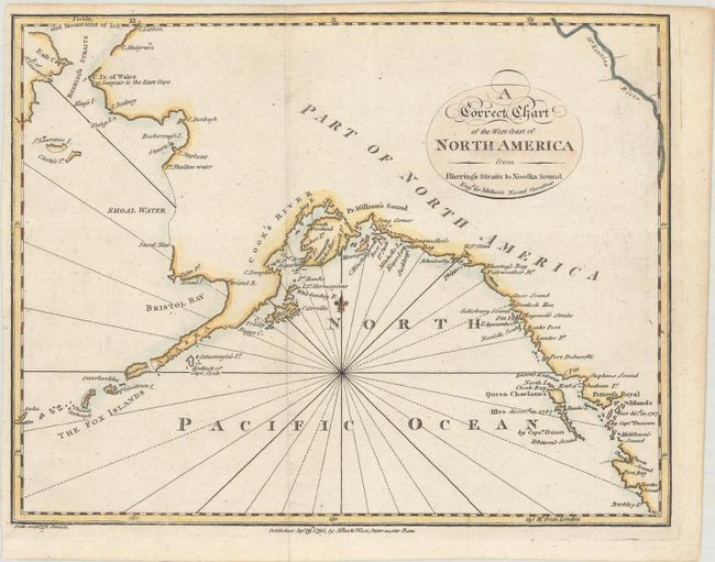
B. A Correct Chart of the West Coast of North America from Bhering's Straits to Nootka Sound, by (Rev.) John Malham, from Malham's Naval Gazetteer, dated 1795 (9.6 x 7.5"). This intriguing chart spans from Queen Charlotte Sound off the coast of British Columbia north to Bering Strait. References are made to the discoveries of Captains Cook, Dixon, and Duncan, but Vancouver's explorations, contemporaneous with the chart's publication, do not appear. The name Alaska appears on the Alaska Peninsula. Much of the coastline north of the peninsula is speculative and terminates in Fields, and Mountains of Ice above Bhering's Straits. The chart was engraved by Neele for Rev. John Malham (1747-1821), a writer and teacher of navigation, for a British edition of The Naval Gazetteer; or, Seaman's Complete Guide. References: cf. Falk 1797-3; McCorkle (18th C. Geography Books) #251, Vol. I-4.
References:
Condition: A
Both maps are issued folding with very faint offsetting.