Subject: Northwestern Africa
Period: 1709 (circa)
Publication: Atlas ou Recueil de Cartes Geographiques
Color: Hand Color
Size:
23.4 x 18.5 inches
59.4 x 47 cm
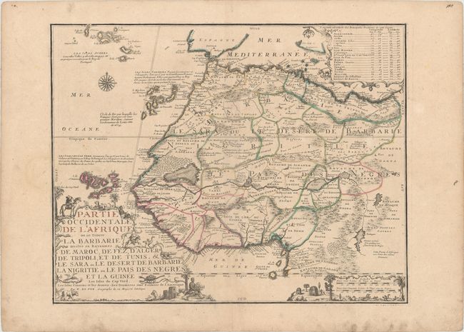
This uncommon, large-format map of Africa is filled with detail, much of which is hypothetical. Political boundaries, towns, and rivers are shown, and mountains and forested areas are graphically depicted. A large "desert swamp" is shown near the Atlantic coast and the Niger River runs horizontally through the map. The map extends to show the Canary, Madeira and Azores Islands, and a number of short notes are found throughout. A table at top right lists the longitudes and latitudes of key locations. The map is handsomely adorned with a compass rose and elaborate decorations surrounding the three cartouches, including natives and various animals, such as an elephant, crocodile, ostrich, scorpion, and lion.
References: Pastoureau, FER II C [92].
Condition: B+
A nice impression with contemporary outline color on wide margined paper with the watermark of a Maltese cross encircled in rosary beads. There is light soiling and a professionally repaired centerfold separation at bottom.