Subject: Northwestern Africa
Period: 1707 (dated)
Publication:
Color: Hand Color
Size:
24.3 x 19.4 inches
61.7 x 49.3 cm
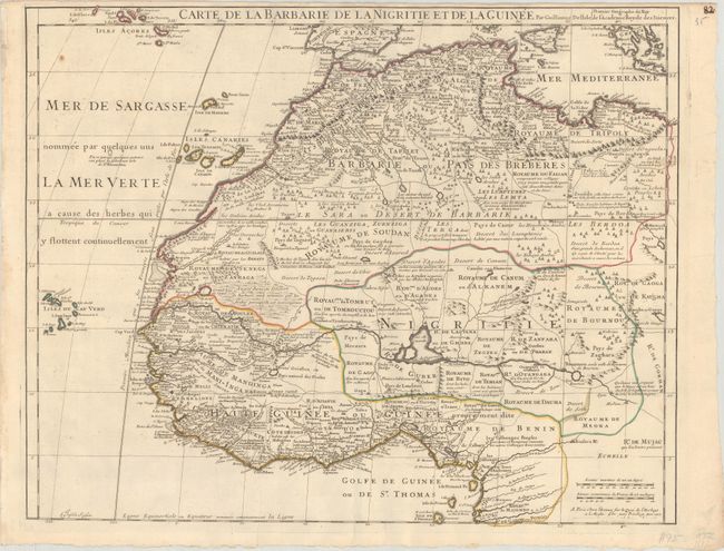
Deftly engraved 18th century map of western Africa from Barbary, Nigeria, and Guinea to below the equator. There is a mass of geographic detail and notations in the interior with information on the rivers and lakes. Numerous tent encampments are depicted throughout the Sahara Desert. A note at the eastern end of the Niger River explains that some believe that the Niger is an "arm of the Nile." Engraved by Charles Inselin. Although dated 1707, this map was likely published later as there is evidence of erasure of part of the publisher imprint at bottom right, which previously stated that the map was also available in Amsterdam "chez L. Renard Libraire prez de la Bourse."
References: Norwich #317.
Condition: A
A nice impression with contemporary outline color on a deckle-edged sheet with a medallion watermark, a couple of short printer's creases at bottom, and a narrow top margin. There are some faint dampstains and light soiling along the edges of the sheet.