Subject: Western Hemisphere - America
Period: 1669 (dated)
Publication: Cartes Generales de Toutes les Parties du Monde…
Color: Hand Color
Size:
22 x 15.6 inches
55.9 x 39.6 cm
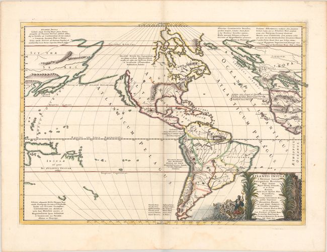
This is Sanson's unusual composition showing ancient geography within a contemporary outline of the Americas, which is noted in the cartouche as the mythical island of Atlantis. This is a purely topographical map and the only cities shown are Mexico City and Cuzco, the capitals of the New World. The continents are divided into ten regions, named for the ten sons of Neptune. The Great Lakes are shown but still very misshapen. A large lake in the western part of North America is the source of a river that empties into the sea between the continent and the island of California. In South America, the mythical Lake Parime appears just north of the equator, but is not named. The map includes both Asian and European coastlines and bits of New Guinea, New Zealand, and Australia. This is the first state as indicated by Burden, dated 1669, with Mariette's imprint.
References: Burden #405; McLaughlin #46; Pastoureau, SANSON V D [208]; cf. Tooley p. 124, #51.
Condition: A
A sharp impression with contemporary outline color in the map and later color in the cartouche, on a bright sheet with a large coat of arms watermark, a hint of toning along the centerfold, and some soft crease at bottom center.