Subject: Southern & Southeast Asia
Period: 1662 (dated)
Publication:
Color: Hand Color
Size:
22.3 x 17.9 inches
56.6 x 45.5 cm
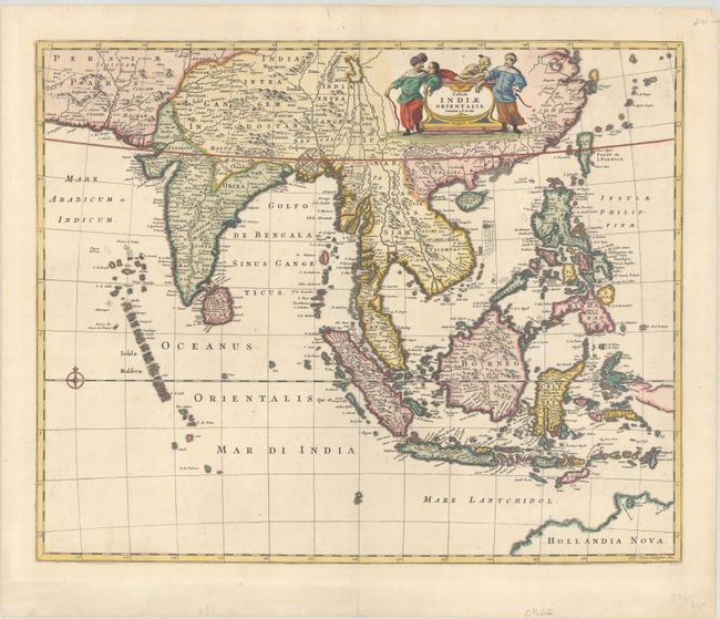
This beautiful map of Southeast Asia was engraved by Joannes Lhulier in 1662. The map covers from southeastern Persia to Formosa (Taiwan), the Philippines, and northern Australia. The many islands are clearly depicted, the ports predominate. The map illustrates the sphere of influence of the Dutch East India Company (VOC) which had built a great trading empire throughout the region in the seventeenth century. Ships coming into Batavia (Jakarta) from the Netherlands carried supplies for VOC settlements in Asia. Silver and copper from Japan were used to trade with India and China for silk, cotton, porcelain and textiles. These products were either traded within Asia for the coveted spices from the Celebes or brought back to Europe. This map served as the prototype for Speed's map of the East Indes.
References:
Condition: A
Fine impression on a bright sheet with a few minor chips and tiny tears in the blank margins, none near the map.