Catalog Archive
Auction 185, Lot 629

"Terrae Israel Omnis Ante Canaan Dictae in Tribus Undecim Distributae Acccuratissima et ad Sacras Historias Intelligendas Opportuniss cum Vicinarum Gentium...", Arias Montanus, Benito
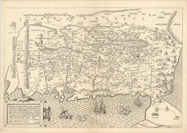
Subject: Holy Land

Period: 1661 (circa)

Publication:

Color: Black & White

Size:
19.5 x 13.2 inches
49.5 x 33.5 cm
Download High Resolution Image
(or just click on image to launch the Zoom viewer)

Uncommon and handsome map of the Holy Land, oriented with east at the top. The map shows the divisions of the eleven tribes as well as 43 Israelite desert encampments represented by tents. The western shoreline goes from Beirut in the north to the Nile Delta in the south. The Kishon River, here called Chedumin flu, connects Haifa Bay and Tiberius Lake (the Sea of Galilee). Five cities appear in the Dead Sea; Sodoma, Gomora, Adamo, Seboim and Segor. There are many place names and cities shown, some in Hebrew. The map is adorned with lovely ships and really adorable sea monsters. This was re-engraved by J. Goddard for a reissue of this important map.

References: cf. Laor #46.

Condition: B+

A crisp impression on a bright sheet with the watermark of the Society of Jesuits and a light dampstain along the centerfold at bottom.

Estimate: $400 - $475

Sold for: $300

Closed on 11/17/2021

Archived