Subject: Eastern Mediterranean & Middle East
Period: 1694 (dated)
Publication: Cartes de Geographie les Plus Nouvelles et let Plus Fideles...
Color: Black & White
Size:
19.8 x 13.1 inches
50.3 x 33.3 cm
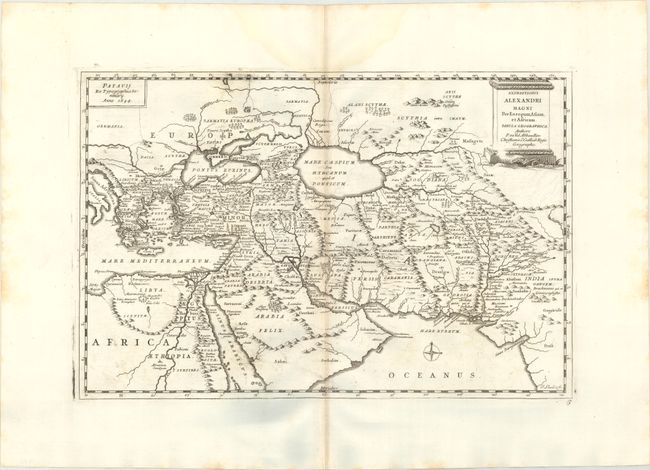
This striking map shows the extent of Alexander the Great's conquests between his homeland in Macedonia through the Persian Empire and northern Africa. It spans from the Balkans, Eastern Mediterranean, and Northern Africa east to the Ganges River. Several place names appear throughout the map, including Pella, Babylon, Jerusalem, Persepolis, and Bactra. There is excellent topographical detail, especially covering the major rivers and mountain ranges. The Caspian Sea is depicted as an oval. A decorative title cartouche adorns the top right corner. Engraved by Lhuilier.
References: Pastoureau, DUVAL II B [114].
Condition: B+
A sharp impression with minor offsetting, slight toning along the centerfold, and a faint damp stain that just enters the map image at top. There is a small abrasion in the title cartouche and minor printer's ink residue.