Subject: Mediterranean
Period: 1676-85 (circa)
Publication:
Color:
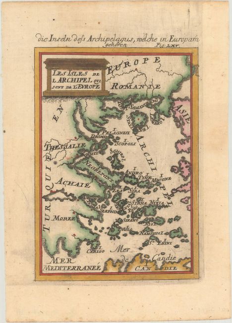
A. Les Isles de l Archipel qui sont de l'Europe, by Alain Manesson Mallet, from Beschreibung des Gantzen Welt-Kreisses, circa 1685, hand color (4.1 x 5.8"). This miniature map covers much of Greece and several Greek island groups, including the Sporades, the North Aegean Islands, the Saronic Islands, and the Cyclades. There is no inland detail. The northern part of I. Candie (Crete) appears at bottom. There is a decorative title cartouche at top left and an alternative German title above the neatline: Die Inseln dess Archipelagus, Welche in Europam Gehoren. Reference: Pastoureau, MANESSON-MALLET I B. Condition: There are a few errant spots of colorist's ink.
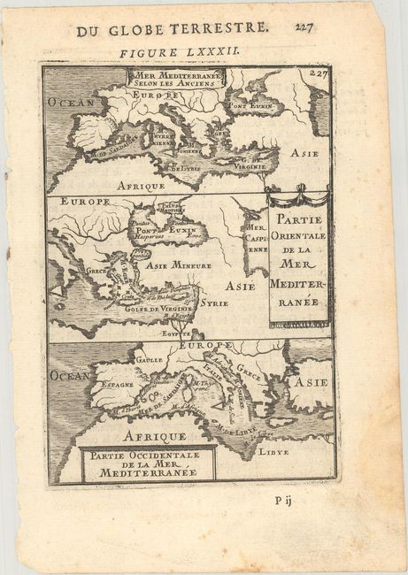
B. Mer Mediterranee Selon les Anciens [on sheet with] Partie Orientale de la Mer Mediterranee [and] Partie Occidentale de la Mer Mediterranee, by Alain Manesson Mallet, from Description de l'Univers, circa 1683, black & white (4.0 x 5.8"). Nice miniature with three maps of the Mediterranean on one sheet, all with drape-style cartouches. The first map, Mer Mediterranee selon les Anciens, shows an overview of the region as it was known to the ancients. The last two maps, Partie Orientale de la Mer Mediterranee and Partie Occidentale de la Mer Mediterranee depict the eastern and western portions of the sea in more detail. French text on verso. Reference: Pastoureau, MANESSON-MALLET I A [82]. Condition: On watermarked paper with minor soiling and a dampstain. all confined to the blank margins.
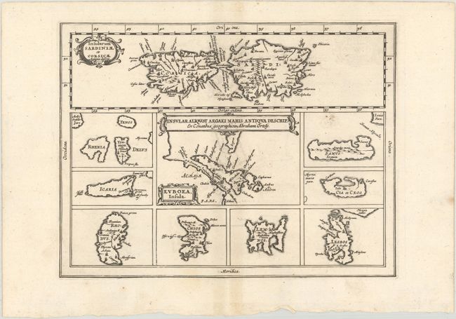
C. Insular Aliquot Aegaei Maris Antiqua Descrip., by Cluver/Jansson, from Introductionis in Universam Geographicam, circa 1676, black & white (8.2 x 6.3"). This small map of Mediterranean islands is based in part on Ortelius. The central map describes the Greek island Euboea and is surrounded by nine maps of other islands. This composition includes the islands of Sardinia and Corsica (Insularum Sardiniae et Corsicae Antiqua Descrip) at top instead of Cyprus, as on Ortelius' map. Three cartouches adorn the map. Reference: Shirley (BL Atlases) T.CLUV-6a #24. Condition: A dark impression on watermarked paper with some light soiling and minor offsetting.
References:
Condition: A
See description above.