Subject: Italy
Period: 1953 (dated)
Publication:
Color: Printed Color
Size:
22.4 x 30.1 inches
56.9 x 76.5 cm
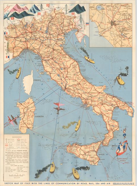
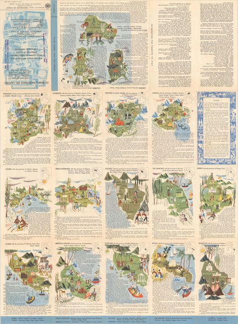
As indicated by the title, this map of Italy focuses on the modes of transportation via land, sea and air. The roads, railways, steamship routes, and air routes are indicated on the map and outlined in a legend at left. Distances between cities are also listed. Images of ships and planes are shown along the routes. An inset at top right shows the region surrounding Rome in greater detail. On verso are pictorial drawings of each of the regions in Italy, accompanied by English text with information about each region and popular tourist sites. The brochure was published by ENIT, the Italian State Tourist Office, and was reprinted from Holidays in Italy by Roberto de Gasperis.
References:
Condition: A+
Clean and bright, issued folding with minor wear along the folds.