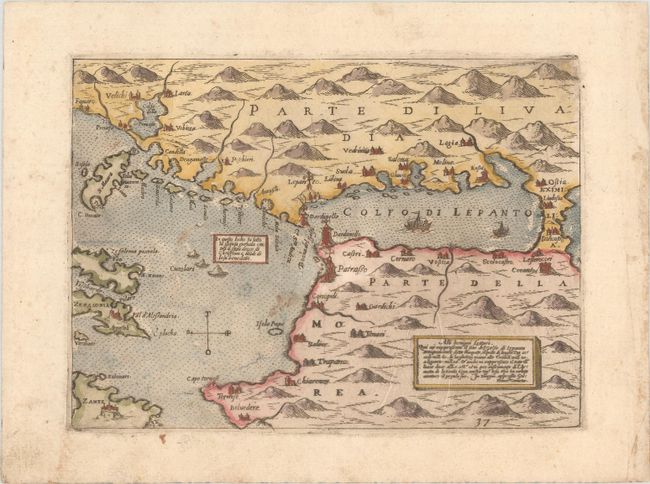
Subject: Gulf of Corinth, Greece
Period: 1572 (circa)
Publication: Isole Famose...
Color: Hand Color
Size:
8.1 x 5.9 inches
20.6 x 15 cm
This unusual map is from a rare 16th-century Italian atlas focused mostly on island maps. It centers roughly on the Golfo di Lepanto (Gulf of Corinth) and extends to include some of the nearby Ionian islands, including parts of Cephalonia and Zakynthos. As the title cartouche notes, the map depicts the location of the Battle of Lepanto, waged between the Holy League and the Ottoman Empire on October 7, 1571, not long before the map was originally published. The battle was a decisive defeat for the Ottoman Empire, and prevented the Ottomans from further advancing into the Mediterranean. An additional note in Latin celebrates the Holy League's victory. Cities are identified along the coasts, and there is nice topographical detail. Curiously, Dardinello appears on either side of the Strait of Rion. This is a later edition of the map with the plate number "37" at bottom right. Camocio was associated with the so-called "Lafreri school" of Italian map-makers, a loosely affiliated group of cartographers, mapmakers, engravers, and publishers who worked in the major Italian publishing centers of Rome and Venice, from about 1544 to 1585. Their maps were often compiled into made-to-order composite atlases and are much desired on the market today.
References: Shirley (BL Atlases) T.CAM-1a #42.
Condition: B+
There is light soiling and a few minor printer's creases.