Subject: Balkans, Northern Greece
Period: 1760 (circa)
Publication:
Color: Hand Color
Size:
24.8 x 18.1 inches
63 x 46 cm
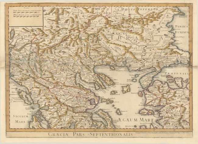
This handsome and detailed map is derived from Delisle's map of the region. It focuses on the northern part of the Greek peninsula and extends to include parts of present-day Albania, Bulgaria, and Turkey. The map features many ancient place names, including the ancient kingdoms of Macedonia, Thracia, and Thessalia. Political boundaries, cities, early roads, rivers, and topography are all identified. This map appeared in many editions; this example was printed for T. Bowles, John Bowles, and Robert Sayer.
References:
Condition: B+
Contemporary color on a sheet with a chip at left and edge tears at left and right that have been repaired on verso. There is some light toning and soiling and a few small wormholes.