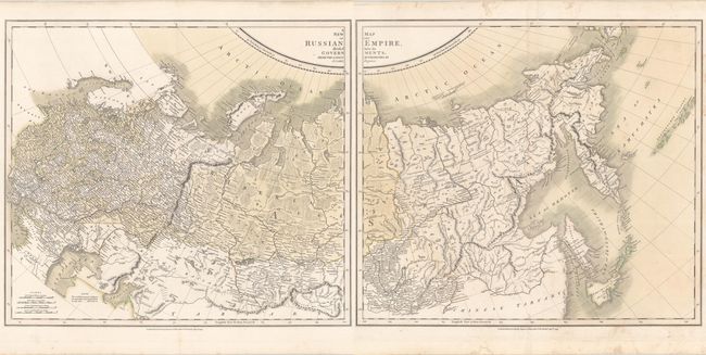
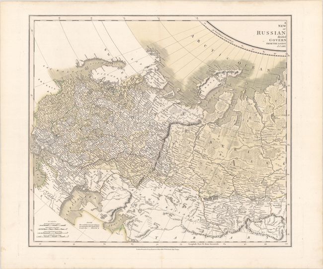
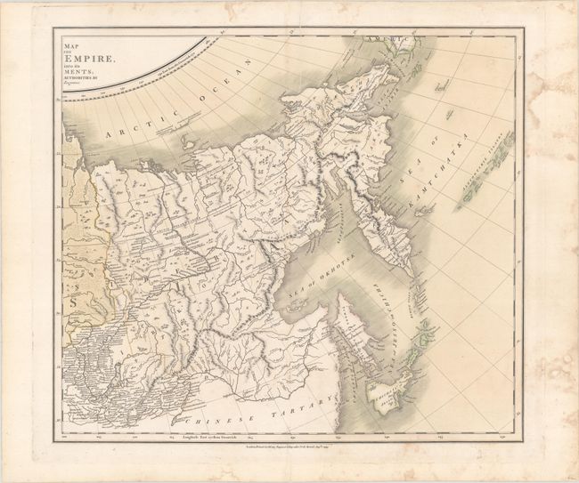
Subject: Russian Empire
Period: 1799 (dated)
Publication: New Universal Atlas
Color: Hand Color
Size:
20.5 x 18.1 inches
52.1 x 46 cm
This exquisitely engraved two-sheet atlas map of Imperial Russia is one of the earliest maps to accurately present the region. It includes many place names and intricate topographical detail of the vast empire's rivers, mountains, forests, plains, and more. Nova Zembla (Novaya Zemlya) is bisected by the Matotchmoi Char (Matochkin Strait). A fragment of coastline in the Arctic is described with two notes: "at this place were found a Kettle & some pieces of cleft Wood" and "Coast discovered by the Hunters of Merchant Liakhov," a reference to Ivan Lyakhov's explorations in the New Siberian Islands. In between Chicha Isd. or Jesso and the Kurile Isles are late depictions of States I. (Staten Island) and Companys I. (Compagnies Land). The Aleutians appear at the far eastern extent of the map.
John Cary was one of the most respected and prolific of English cartographers at the beginning of the nineteenth century. When the Ordnance Survey began accurately mapping the UK, they used John Cary's style as the basis for their work.
References:
Condition:
Contemporary color on watermarked paper with remnants of hinge tape on verso. The western sheet is in A condition. The eastern sheet is in B+ condition, with light soiling, including stains that are largely confined to the blank margins, several small tears around the centerfold that have been archivally repaired on verso, and a printer's crease at top. The first image is a composite image - the map is in two separate sheets.