Catalog Archive
Auction 185, Lot 530

"Ducatus Pomeraniae cum Magna Maris Balthici et Provinciarum ad Nexarum Parte ad Delineationem Novissimam...", Seutter, Matthias

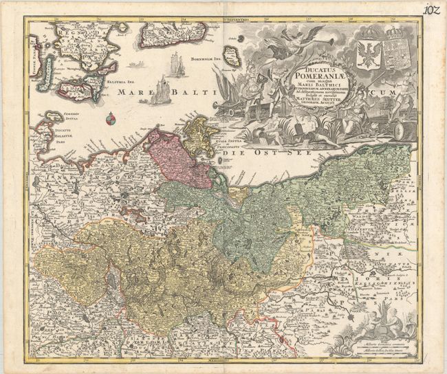
Subject: Eastern Germany & Western Poland

Period: 1730 (circa)

Publication:

Color: Hand Color

Size:
22.2 x 19.4 inches
56.4 x 49.3 cm
Download High Resolution Image
(or just click on image to launch the Zoom viewer)

This handsome German map centers on the Szczecin Lagoon and covers the area surrounding the modern-day border between Germany and Poland. The map spans from Halberstadt east to Gdansk and extends to show some of the Danish islands, most notably Lolland and Falster. It is rich with detail, showing political boundaries, towns, cities, rivers, and forests. An elaborate title cartouche dominates the upper right corner of the map image, featuring coats-of-arms and mythological figures, including Mercury, Athena, Fame, and river gods.

References:

Condition: A

A sharp impression with full contemporary color on a bright sheet with some minor creasing at top center and marginal soiling and foxing.

Estimate: $240 - $300

Sold for: $180

Closed on 11/17/2021

Archived