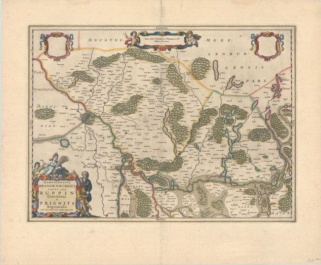
Subject: Northern Germany
Period: 1659 (circa)
Publication:
Color: Hand Color
Size:
20.8 x 15.3 inches
52.8 x 38.9 cm
This handsome map depicts the region between Hamburg and Berlin, including parts of Mecklenburg-Vorpommern and Brandenburg. The map extends from Wittenburg in the northwest to Kremmen in the southeast, identifying dozens of tiny towns. The rivers, forests and lakes in the region are graphically depicted. The map is adorned with four decorative cartouches, including two blank ones. The title cartouche features a hunter and a figure representing the bounty of the harvest. Blank verso.
References: Ven der Krogt (Vol. II) #2172:2.
Condition: A
A dark impression on a bright sheet with a large watermark of the god Atlas, light printer's ink residue, a repaired centerfold separation at top, and marginal soiling.