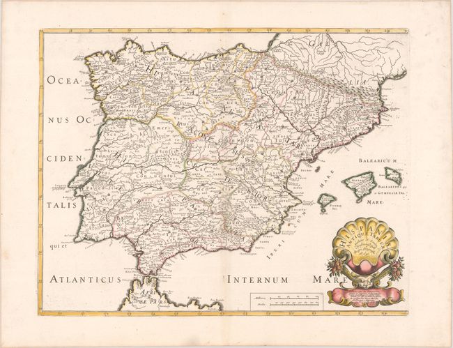
Subject: Spain & Portugal
Period: 1641 (dated)
Publication: Cartes Generales de Toutes les Parties du Monde...
Color: Hand Color
Size:
20.7 x 16 inches
52.6 x 40.6 cm
This handsome map of the Iberian Peninsula delineates the former political divisions during the time of ancient Rome. The map extends to include the Balearic Islands. There is nice topographical detail throughout. It is decorated with a rather fantastical cartouche showing two horns of plenty erupting from a bull's head beneath a stylized shell.
References: Pastoureau, SANSON V A [111].
Condition: A
A dark impression with contemporary outline color in the map and later color in the cartouche, on a bright sheet with the watermarks of a large coat of arms and the symbol for the Society of Jesus. There is a hint of toning along the centerfold and a few tiny spots of foxing in the image at far right.