Catalog Archive
Auction 185, Lot 490

"L'Alsazia Divisa nel Langraviato dell' Alta e della Bassa Alsazia...", Cantelli da Vignola/de Rossi

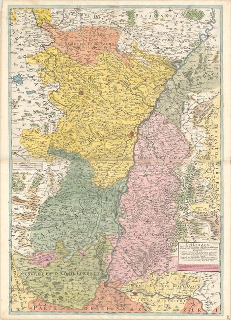
Subject: Western Europe

Period: 1690 (dated)

Publication:

Color: Hand Color

Size:
22.4 x 32.3 inches
56.9 x 82 cm
Download High Resolution Image
(or just click on image to launch the Zoom viewer)

This impressive two-sheet map is centered on Strasburg and depicts the Rhine River from Speyer to Basel, and then east to Waldshut-Tiengen. There is excellent detail of cities, political boundaries, river systems, mountains and forests. Engraved by Franciscus Donia.

References:

Condition: A

Sharp impressions on bright sheets with four small worm holes in the image at left and minor foxing and dampstains in the blank margins.

Estimate: $275 - $350

Sold for: $200

Closed on 11/17/2021

Archived