Catalog Archive
Auction 185, Lot 475

Map of Prussian Partition from 1772-1795

"Carte Generale de la Pologne. Avec ses Differens Demembrements par les Puissances Partageantes, en 1773 et 1795", Tardieu

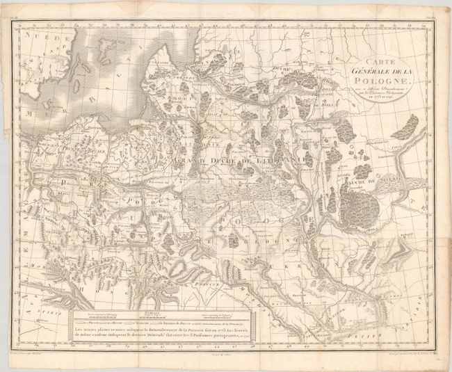
Subject: Baltic, Poland

Period: 1795 (dated)

Publication:

Color: Black & White

Size:
20.4 x 16 inches
51.8 x 40.6 cm
Download High Resolution Image
(or just click on image to launch the Zoom viewer)

This detailed map shows the elimination of the Kingdom of Poland and the Grand Duchy of Lithuania (Polish–Lithuanian Commonwealth) through partitions of the land by Prussia, Russia, and Austria between 1772-1795. The map is filled with topographical information, boundary lines, towns, and the river systems in the region. A legend at bottom was intended to identify the color-coding system used on the map to depict the Prussian, Russian and Austrian partitions in 1772 (here noted as 1773) and 1795, however this example has not been colored. Designed by Mariaval and engraved by Tardieu with lettering by Pelicier.

References:

Condition: B+

Issued folding with light soiling and several dampstains in the top blank margin.

Estimate: $400 - $500

Sold for: $300

Closed on 11/17/2021

Archived