Subject: Europe
Period: 1945 (dated)
Publication:
Color: Printed Color
Size:
37.9 x 27.9 inches
96.3 x 70.9 cm
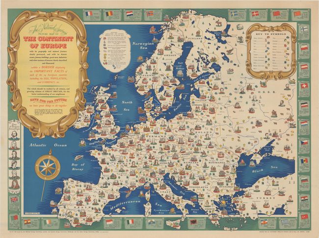
This colorful pictorial map was created by H. Charles Paine and illustrates the natural resources, historic figures, and important landmarks for each country. A legend is included at top right to identify each of the resources, such as coal, oil, timber, wheat, oranges, cattle, wine, and tobacco. An inset in the Norwegian Sea lists which counties in the British Isles are known for each resource. The border of the map features the flags of each country along with some basic facts, as well as the portraits of famous people from the British Isles, such as William Shakespeare, Sir Isaac Newton, and Florence Nightingale. Published at the end of World War II, the map was issued jointly by the National Savings Committee, the Scottish Savings Committee and the Ulster Savings Committee to offer "better understanding of our neighbours." The title cartouche also encourages citizens to "save for the future," which was a common motto used by the National Savings Movement to encourage individuals to save their money in government backed products to help finance the government. Printed for H.M. Stationery Office by Mardon, Son & Hall Ltd.
References:
Condition: A
A clean and bright example with just a hint of soiling and minor creasing along the edges of the sheet.