Subject: Cayenne, French Guiana
Period: 1729-64 (circa)
Publication:
Color: Hand Color
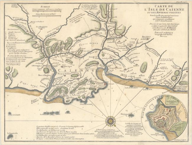
A. Carte de l'Isle de Caienne et des Rivieres Voisines dans la Quelle on a Marque Nomenent Toutes les Habitations qui Composent Actuellement Cette Colonie Francoise..., by Jean Baptiste Bourguignon d'Anville, dated 1729 (17.0 x 12.8"). Attractive chart of the coast of French Guyana locating the important fortifications and natural harbor of Cayenne. There is excellent detail of rivers, towns, political boundaries, and mountains throughout the area, and soundings are marked in the Atlantic Ocean. Numerous notes are included regarding the terrain and availability of resources, and below the map is a brief history of Cayenne. At bottom right is a an inset with a bird's-eye plan of Fort St. Michael in Cayenne. Condition: A nice impression on paper with a "D[heart]B" watermark, a few small spots, and a couple archival repairs made along the neatline at top and bottom right. (B+)
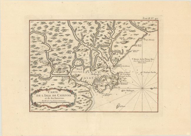
B. Carte de l'Isle de Cayenne et de ses Environs, by Jacques Nicolas Bellin, from Le Petit Atlas Maritime..., circa 1764 (11.3 x 8.1"). This nicely engraved chart covers the natural harbor of Cayenne and its surroundings in French Guiana. There is nice detail of the region's watershed and topography. Soundings and rocks appear in the water. Condition: A crisp impression with a few tiny spots. (A)
References:
Condition:
See description above.