Subject: Northern South America
Period: 1853 (published)
Publication: Sen. Ex. Doc. No. 36, 32d Congress, 2nd Session
Color:
In 1851, Lieutenant Herndon was commissioned to lead the first American expedition of the Valley of the Amazon, "to explore the Amazon, to sound its streams and to report as to their navigability." He also was commanded to "examine its fields, its forests and its rivers that he might gauge their capabilities, active and dormant, for trade with the states of Christendom and make known to the spirit and enterprise of the age the resources which lie in concealment there waiting for the touch of civilization." The exploration and resulting report were made under the direction of the U.S. Navy Department. Herndon journeyed through parts of Peru, Bolivia and Brazil for nearly a year and went on to become the captain of the ill-fated Central America, which sank in 1857 with a load of gold and newly minted gold coin from the Carson City mint. The gold, valued at more than a billion dollars, was recovered in a deep water project completed in 1989.
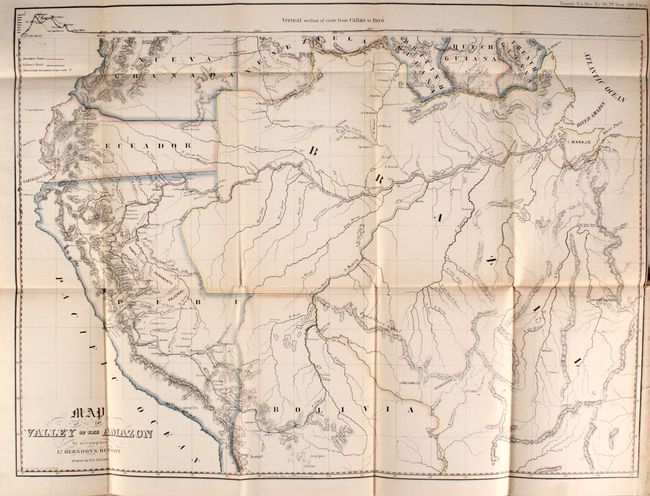
A. Map of the Valley of the Amazon, printed color (23.6 x 17.6"). This seldom seen map details the basin and valley of the Amazon River. The range extends from the Pacific in Peru and Ecuador to the Atlantic and the mouth of the Amazon at the I. Marajo. The watershed is shown in great detail and the tracks of both Herndon and Lt. Lardner Gibbon, who was ordered to explore a different area of the Amazon, are also depicted. At top is a view of a Vertical Section of Route from Callao to Para. Drawn by H.C. Elliot. Condition: There is minor toning along the folds, a few tiny splits at fold intersections, and a tiny binding tear at right. (B+)
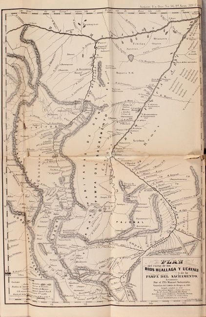
B. Plan del Curso de los Rios Huallaga y Ucayali y de la Pampa del Sacramento, black & white (10.8 x 15.4"). This map covers the area in Peru south of the Maranon River and west of the Ucayali River. It shows cities, towns, mountain passes, and native inhabitants. Pampa del Sacramento is prominently depicted. Condition: There are several short tears, light toning along the folds, and a damp stain in the center of the map. (B)
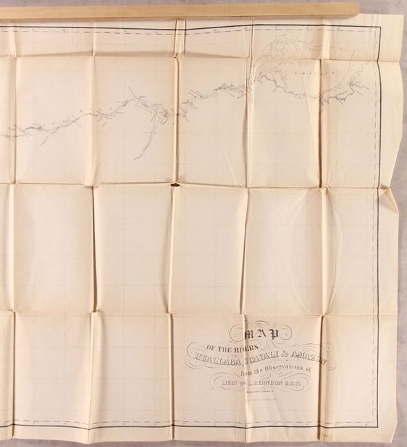
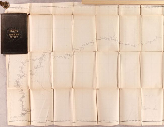
C. Map of the Rivers, Huallaga, Ucayali & Amazon..., black & white (57.8 x 25.4"). This map traces the path of the river system from Lake Marajo to the Pacific Ocean. It locates hundreds of place names, forts and factories along the route. Condition: There is a 3.5 binding tear at left, light toning along the folds, a small damp stain, and several short separations, especially at fold intersections. At top left there is a small chip with minor loss to an unengraved area. Wood pieces on sides in images are not attached to the map. (B+)
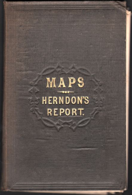
Hardbound in original brown cloth covers (6 x 9") with decorative embossing and gilt title "Maps- Herndon's Report".
References:
Condition:
Maps are in B+ and B condition; see description above for a more thorough description. Covers are good with minor sunning along the spine, slightly bumped corners, and some damp stains.