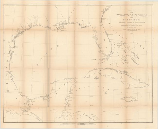
Subject: Gulf of Mexico, Florida
Period: 1852 (dated)
Publication: Communication from the Secretary of the Treasury…
Color: Black & White
Size:
33.6 x 26.8 inches
85.3 x 68.1 cm
This large map is centered on the Gulf of Mexico and extends to cover all of Florida, the Gulf Coast south to Honduras, and the islands of Cuba, Jamaica, and the Bahamas. Detail is confined to the coastline including place names, rivers and bays. Printed on two sheets and joined.
Israel Andrews was a U.S. consul to Canada at the time and was a proponent of stronger economic relations between the two countries. This map was part of his report to Congress that helped establish the Reciprocity Treaty of 1854, which eliminated customs tariffs between the two countries.
References:
Condition: B
Issued folding with light toning along the folds and faint offsetting. There are several small splits at the fold junctions with minute loss at one junction.